|
|
|
20-Mile Route
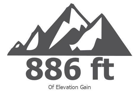
21 rolling miles with 886 feet of elevation gain. You will ride through downtown LaGrange the "Kindness Capital of Kentucky" A town that boasts having CSX railroad trains barreling through downtown Main street, so BE careful, but it is a must see. After passing through town, you will find yourself on rolling hills as you ride toward your rest stop at Cabin Creek Farm at mile 15.5. While there, enjoy the music and the OKHT world famous Cookie Stop! There is just one more challenging hill before you finish at 3rd Turn Oldham Gardens. | 40-Mile Route
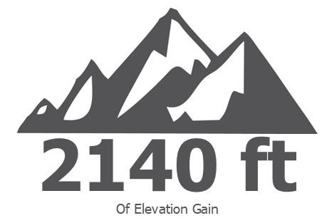
38 miles with 2,140 feet of elevation gain. You will ride through downtown LaGrange the "Kindness Capital of Kentucky", A town that boasts having CSX trains barrel through downtown Main street, so be careful, but a must see. Continue on the rolling hills as you bike through the 4100 acre horse farm community of L' Sprit. The rolling hills and scenery keep going as you approach Cabin Creek Farm which is the second rest stop at mile 28.6. Enjoy the music and the OKHT world famous cookie stop. Challenging hills await as you reach the quiet and scenic Cedar Point and New Cut roads. The payoff is the stretch down Glen Arm Road where you just might spot a llama or two and a dairy farm. From there it’s a short trip to finish at finish at 3rd Turn Oldham Gardens. | 62.1-Mile (100k) Route
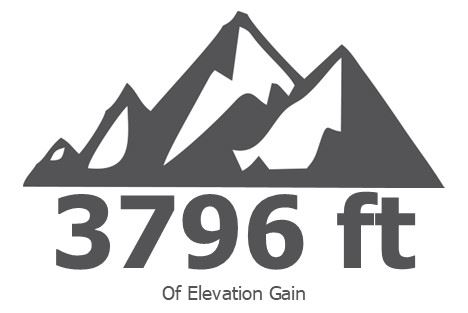
64 miles with 3,796 feet of elevation gain. This is our longest and most challenging route that will definitely put the most experienced riders legs to the test. This route encompasses all that you see on our shorter routes PLUS 3 major climbs, and first stop at mile 16.2, Cabin Creek Farm stop at mile 32.5. Remember what goes up, must come down. As some of the climbs are challenging, so are the descents! Be careful on these steep winding descents!. Caution signs will be out there for your safety. The last stop, Chestnut Hall, at mile 53.1 is a beautiful retired thoroughbred racehorse sanctuary. The home stretch will be Glen Arm road. Enjoy this road because you might see a pig, goat, or llama, dairy farm and a few other surprises. The finish line is at finish at 3rd Turn Oldham Gardens. |
|

Ride with GPS Links |
Cue Sheets |
How to Use the OKHT Ride with GPS |
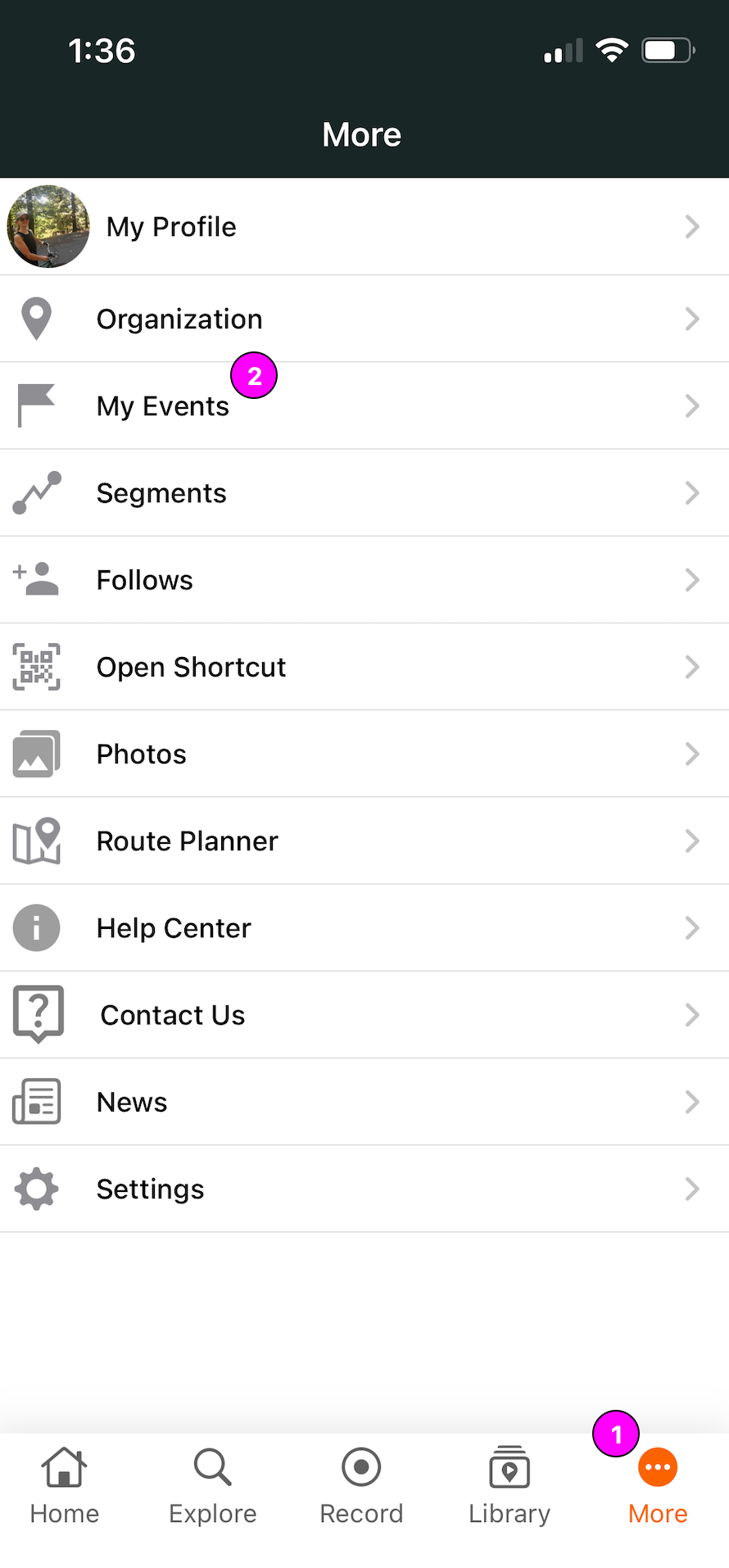
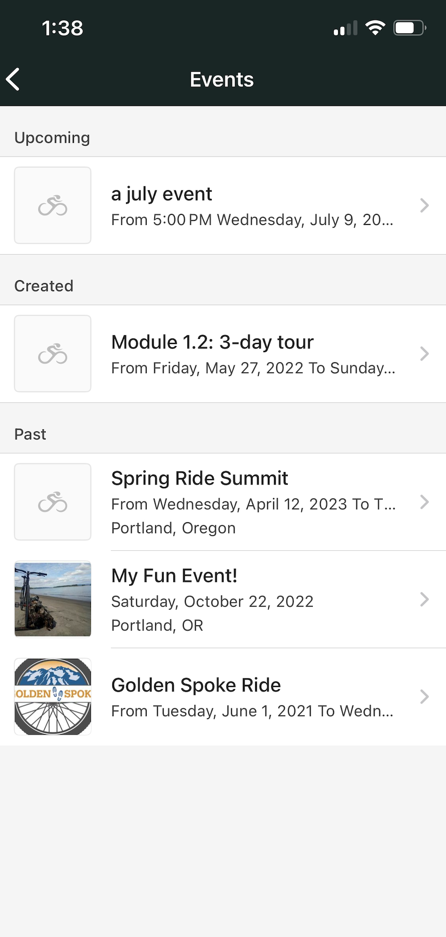
Events on the Mobile App |
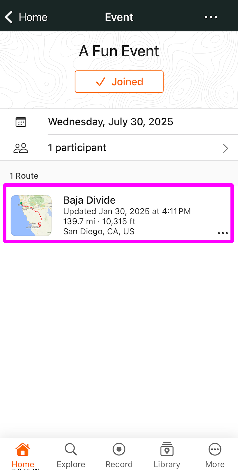
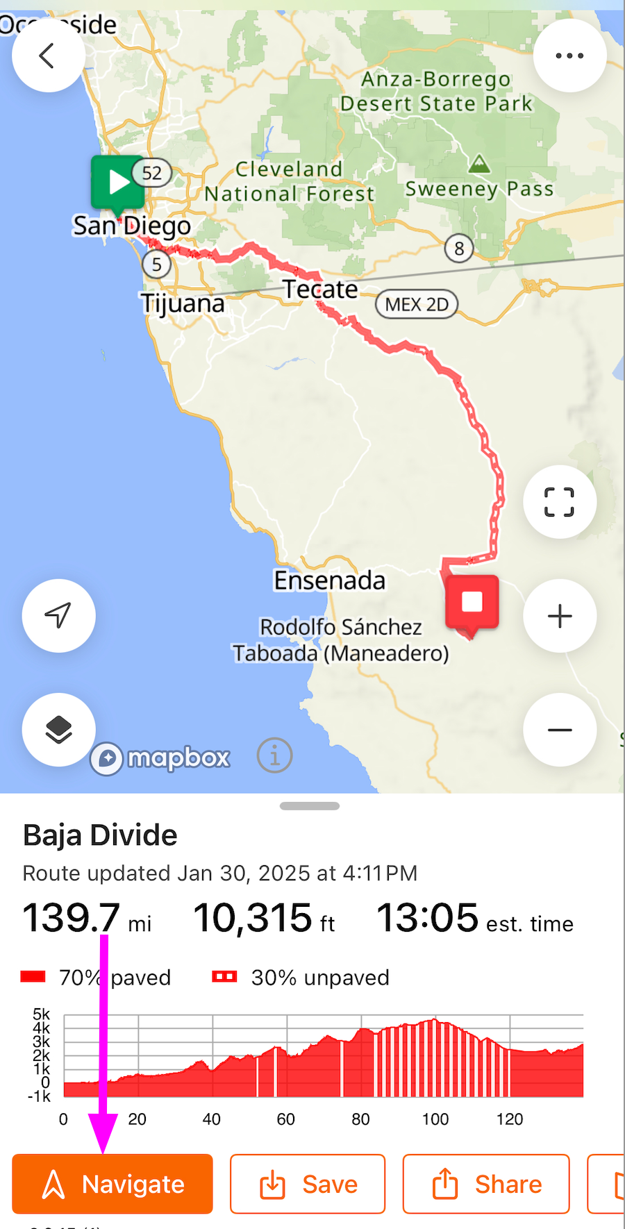
Navigate an Event RouteOnce you have joined an event using your Ride with GPS account, you can navigate the event courses using the mobile app. Your event and routes will already be synced to your account.
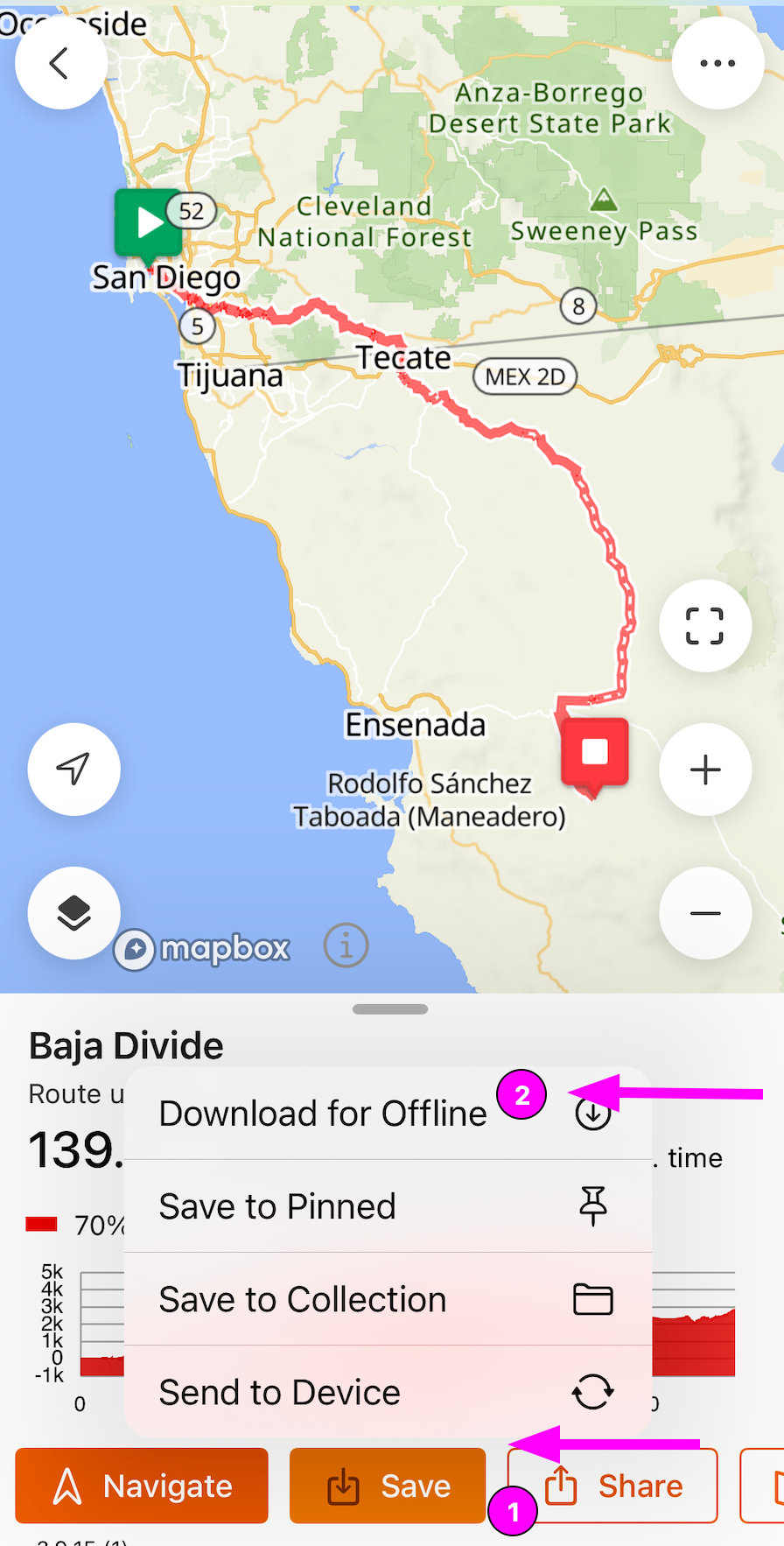
Offline MapsYou can download your Ride with GPS event routes for use offline to save your phone battery and/or avoid using data while riding. To download maps for use offline, tap the Save button on the bottom row of the route preview screen, then tap Download for Offline. It may take a few minutes to download. This works best when connected to a wifi network. Once your download is complete, you will have full access to that route and map even when you are not connected to a cellular network or wifi. Learn more about downloading maps for offline use.
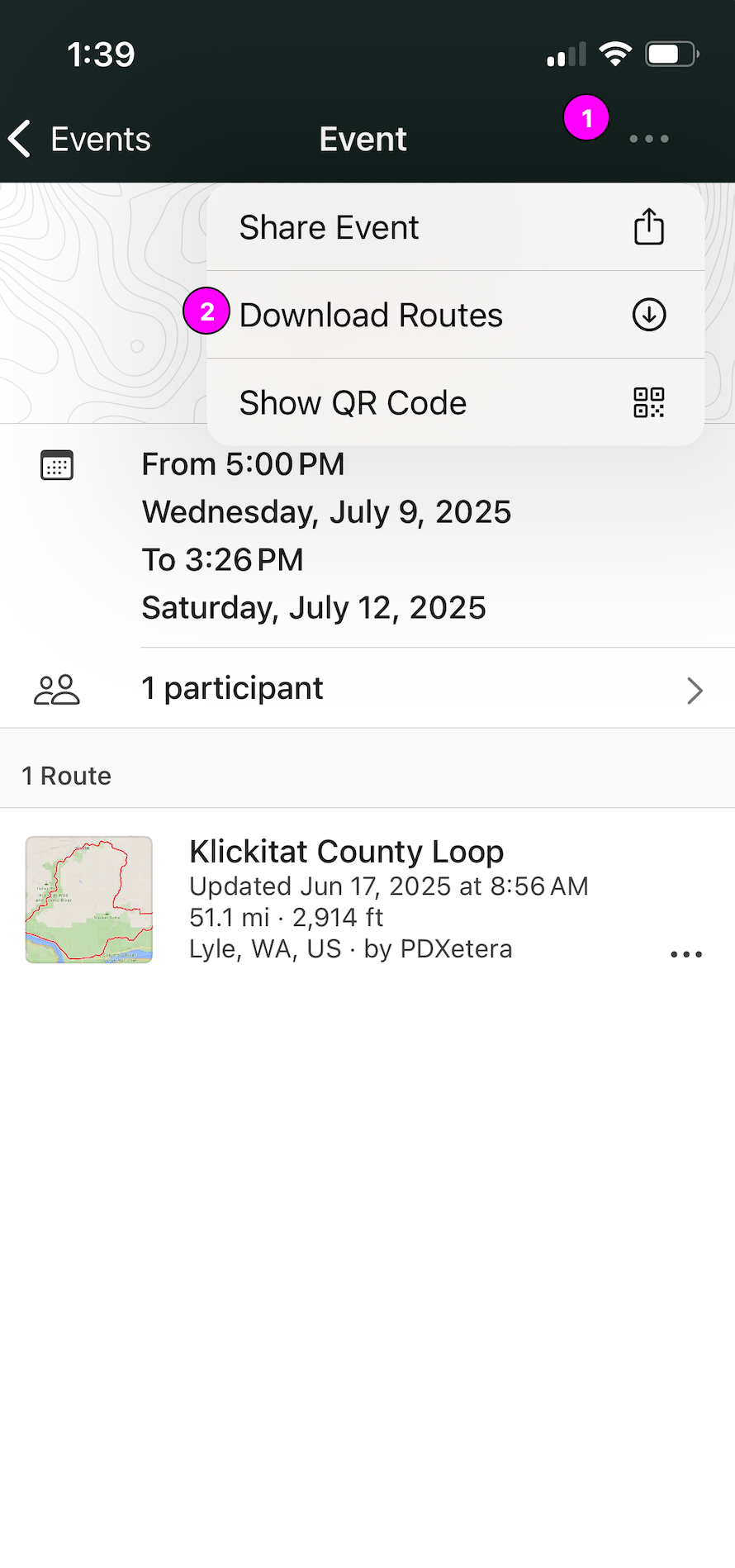
Download All Routes for EventsWhile viewing an event page in the app, you can download all the routes associated with the event with one tap rather than having to select each route individually.
Send event routes to your GPS device from the mobile app
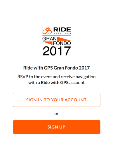
Events on the WebsiteWhen you sign up for an event that uses Ride with GPS maps and navigation, the event organizer will provide you with an auto-approval link you can use to RSVP to the event, sync the event with your account, and unlock free navigation features for the event routes.
Once you click the link, you will be asked to sign up if you are new to Ride with GPS or sign in if you already have a Ride with GPS account. The event will automatically be synced to your account and will be available both on the mobile app and website.
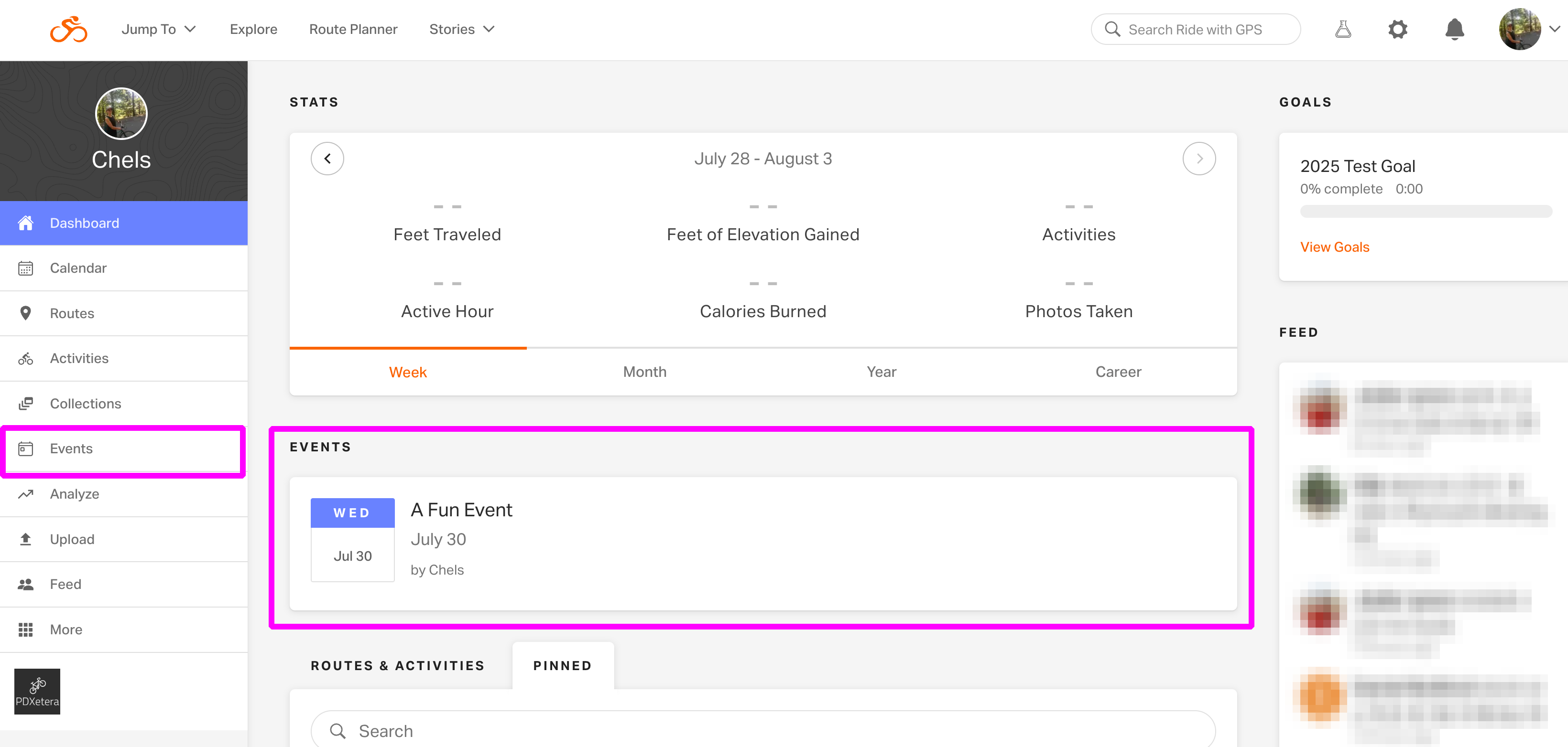
 When accessing the event from the Ride with GPS website, you’ll find it listed under the Events section of your dashboard.
Send event routes to your GPS device on the webFrom the event page, click Send to Device under the route you want to transfer to your device and follow the prompts to select your device, connect your account, and wirelessly sync. Learn more about syncing your routes to your Wahoo device and to your Garmin device. PDF Map and CuesheetsYou can create and print PDF files of the event route maps and cue sheets. From the event page, click Go to Route to view the individual route page. Then click More > Print Map & Cue PDF. Learn more about printing PDF maps and cuesheets. |


|